
Description
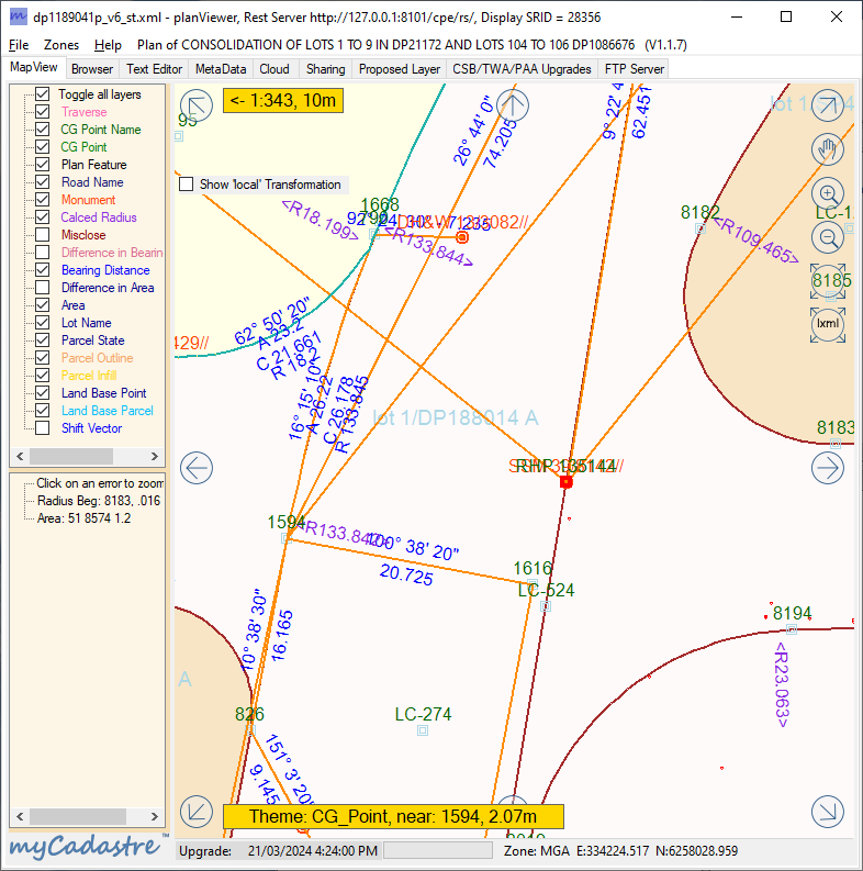
‘planViewer’ is a tool for surveyors to check plans expressed as a Land XML File.
It supports all Australian and New Zealand variations.
The user can turn the various layers on and off to reduce clutter and to concentrate on the layers of interest.
Validation is the main delivery of ‘planViewer’, in a surveyor friendly presentation with bearings and distance displayed along the survey lines.


Reviews
There are no reviews yet.