Description
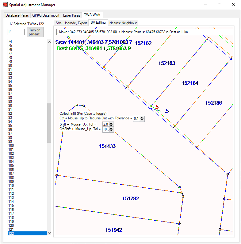
SAManager is a fully functional Windows Application that has been developed over 40 years by Spatial Tapestry.
This is far superior to the QGIS Plugin on offer, and includes numerous settings for Themes, being:
Maintain Straight Lines -> SL Tol in (cm): (and)
Straighten -> Max Deflection Angle (Deg):
SAManager can detect those parts of LineString and
MultiLineString themes that are ‘roughly’ straight, meaning that there is a set
of consecutive points with a Peuker Douglas tolerance within the specified
value, and where the maximum deflection angle is within the specified value.
Once these straight lines are detected, these straight pieces can be maintained
and straightened.
<- Maintain Implied Vertical Topology
SAManager can detect and maintain LineString start and end
points which appear to be on top of another LineString theme, but where the
start/end point is not in the other theme. An example of this would be a water
feeder theme going from the mains into the lots, but where a water mains only
includes its own start and end and bend points.
<- Maintain Intersection Bearing – (*** not proportion***)
Some themes such as water feeder/lateral pipes are often
built at right angles from the mains to reduce costs. The often random
direction and size of shift vectors along road frontages and around the lots
will tend to rotate these lateral pipes. This option attempts to move the
intersection point along the mains to keep the original intersection bearing.
There are limitations, as the intersection cannot be moved
past the mains start or end points, or past any bend point, or past any other
intersection point. Doing so would cause a ‘Z’ topology.
Scaled LineString Object
The geometric manipulation for this treatment is
complicated, but generally works well in practice.
Some themes such as water and sewer mains can benefit from
this processing.
Linestrings less than 400-500m are treated to a 2 point
transformation using the start and end point.
Linestrings longer than this often have issues as the road
frontage corners often shift in a way that cause undesirable offsets, and as
such a 2 point transformation is not applied.
The offset to the nearest road boundary is calculated during
the data loading process. This offset is used to nudge points back to the
original offset during each iteration. This competes with all the other
processes, but does have a good influence on the placement of these linestring
features.
The nett result of this processing might be best described
as adding a certain stiffness to the linestring, generally keeping the shape
but accommodating road frontages that have changed more than most normally do.
Snap this Theme To ‘Snap to Themes’
Some themes, such as suburbs, LGA and other Admin themes,
often have missing/additional nodes along the Destination Landbase.
SAManager can detect this and do the necessary edits to have
the theme co-incident with the Target Snap to Themes.
This Theme Is a target ‘Snap to Theme’
Usually this is the Destination Cadastre, but if (say) new Suburb boundaries were provided then that could also be tagged a ‘Snap to Theme’.
Remove Spikes -> Tol (mm):
Spikes, ‘V’ and ‘Z’ like shapes can be created with the
above ‘non-upgrade’ options, and often exist in the original geometry.
Rigid Object support for Polygons (only)
This set of parameters defines how SAManager finds and
processes groups of features within the current theme. The features are defined
by a field name and a value in that field. E.g. The Field name might be
‘GroupId’, and all the features with the value of (say) 123 are treated as the
one feature.
Each point goes through the IBG process, being shifted by
the shift vectors to give an adjusted coordinate. The adjusted coordinates for
all the features within a group are compared with the original to compute an
average X and Y shift, which is applied to all those point. If ‘Allow Rotation’
is checked, the two furthest apart points are used to compute a rotation. A
Similarity Transformation is then applied to all those points.
Rigid Polygon Object
This must be set for this processing to take place.
Allow Rotation
This is set of the groups of features can be rotated.
SD Group Field Name:
This is the field name of the field holding the group value.
SD Group Name (*/value):
If there is a subset of the group values that should be
processed, and not the other features, then this can be used to limit this
processing to that subset.


Reviews
There are no reviews yet.